SEI News
New Release: Tippie Ranch 3D Survey
Seismic Exchange, Inc. is pleased to announce the release of the Tippie Ranch 3D survey, which comprises 34.64 square miles located in Limestone County, Texas, that was recently acquired from New Horizon Global, Inc. and is currently available for licensing.
Tippie Ranch 3D - 34.64 square miles
Additional information and shapefiles are available upon request or by visiting our interactive map at www.seismicexchange.com.
New Release: Haynesville 3D (2025 Reprocessing)
Seismic Exchange, Inc. is pleased to announce the release of the Haynesville 3D (2025 Reprocessing) which covers 1,794.96 square miles in Panola and Shelby Counties, Texas and Caddo, Bossier, Bienville, Red River, Sabine, De Soto and Natchitoches Parishes, Louisiana. The Haynesville 3D was reprocessed by In-DepthGeophysical, Inc. and is currently available for licensing.
Haynesville 3D - 1,794.96 square miles
Additional information and shapefiles are available upon request or by visiting our interactive map at www.seismicexchange.com.
New Release: Fort Peck 3D Survey
Seismic Exchange, Inc. is pleased to announce the release of the Fort Peck 3D survey, which comprises 106.45 square miles located in Roosevelt & Richland Counties, Montana, that was recently acquired from Bryce Phillips and is currently available for licensing.
Fort Peck 3D - 106.45 square miles
Additional information and shapefiles are available upon request or by visiting our interactive map at www.seismicexchange.com.
New Release: 3D Surveys previously owned by JOG Corporation
Seismic Exchange, Inc. is pleased to announce the release of the following 3D surveys that were recently acquired from JOG Corporation and are currently available for licensing.
North Dakota
Ash Creek 3D Survey (1995 Original Processing) – 13.71 square miles (Stark County)
Clay Butte 3D Survey (1995 Original Processing) – 71.76 square miles (Stark County)
County Line 3D Survey (1994 Original Processing) – 2.5 square miles (Stark & Dunn Counties)*
*(no processed data is available only field data and support)
Divide 3D Survey (1998 Merged Original Processing) – 52.06 square miles (Divide & Williams Counties)
Killdeer 3D Survey (1995 Original Processing) – 41.42 square miles (Dunn County)
Seminole County, Oklahoma
Salt Creek 3D Survey (1987 Original Processing) – 1.65 square miles
Additional information and shapefiles are available upon request or by visiting our interactive map at www.seismicexchange.com.
New Release: Iberville 3D (2024 Reprocessing)
Iberville 3D - 5.35 square miles
New Release: San Bernard River 3D Survey
Seismic Exchange, Inc. is pleased to announce the release of the San Bernard River 3D survey, which comprises 176.08 square miles located in Wharton, Fort Bend & Brazoria Counties, Texas, that was recently acquired from Ballard Exploration Company and is currently available for licensing.
San Bernard River 3D Survey - 176.08 square miles
Additional information and shapefiles are available upon request or by visiting our interactive map at www.seismicexchange.com.
New Release: University Lands/Slaughter Ranch and Grey Ranch 3D Surveys
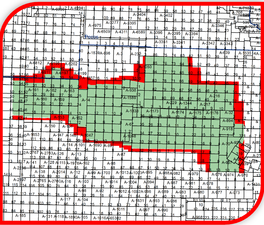
University Lands/Slaughter Ranch 3D Survey – 190.63 square miles

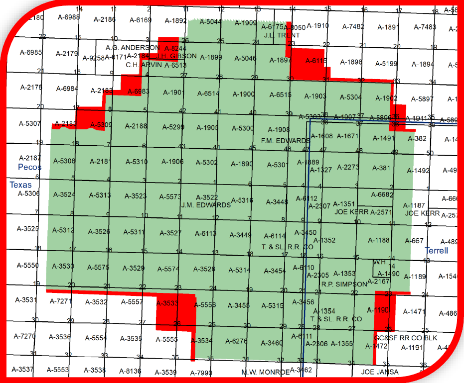
Grey Ranch 3D Survey – 73.26 square miles

SEI Acquistion of CGG US Land 3D Data
Click on the links below to see the additional data now available in each of the respective areas.

